My colleagues Stefano De Sabbata, Daniel Chavez Heras, and I have a new short paper out, accepted for Spatial Humanities 2022. After many years of rumination, we have finally started doing some geospatial analytics on film data, which I find very exciting. 🎬🗺📈
Abstract: Films are deeply geographical. Externally, they are produced in places, across increasingly com- plex and shifting global networks that connect organisations, cities, professionals, and equipment. Internally, their imagined geographies are set in either real or fictional places, and refer to their social, political, and cultural facets. In this study, we adopt a cultural analytics approach to commence an investigation of the spatial dimension of films, focussing on toponyms in film plots. Using geoparsing, we extract toponyms from about 42,000 film plots from Wikipedia and we analyse their spatial distribution by country. We then consider the relationship between a film’s country of origin and the plot toponyms, charting the flows from places where films are produced to the geographies evoked in their stories.
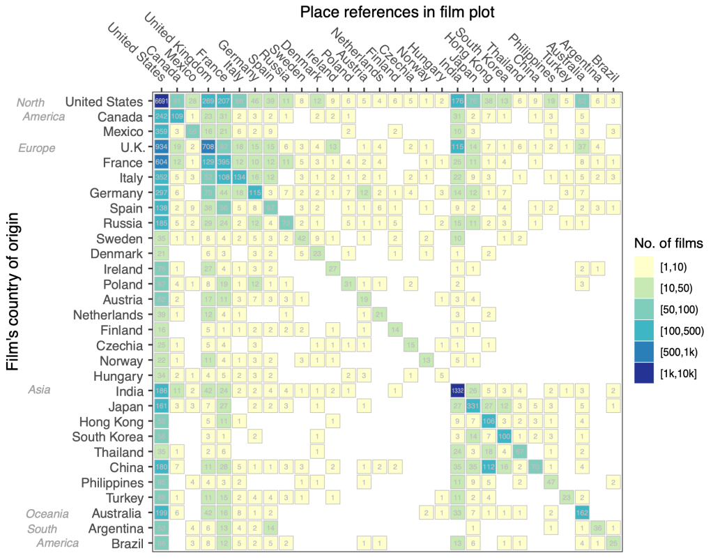
Flows at the country level from a film’s country of origin to the country to which the plot refers to. The data was simplified by only considering only the main country of origin in the case of co-productions. If a film references toponyms in multiple countries, it is counted once in each cell. For example, 22 Italian films reference places in India. Data source: 20,821 film plots from Wikipedia (1888–2013).
Reference: A. Ballatore, S. De Sabbata, and D. Chavez Heras (2022) Plotting film toponyms: A study in cultural geo-analytics. Spatial Humanities 2022, Ghent, Belgium.
Full paper:
