In this new article, my colleagues of the SeaSketch team, Werner Kuhn, and I developed a questionnaire to evaluate the usability of participatory GIS [read the full paper in PDF]. The article was nominated as Best Full Paper at AGILE 2019.
All the data and resources are freely available on GitHub.
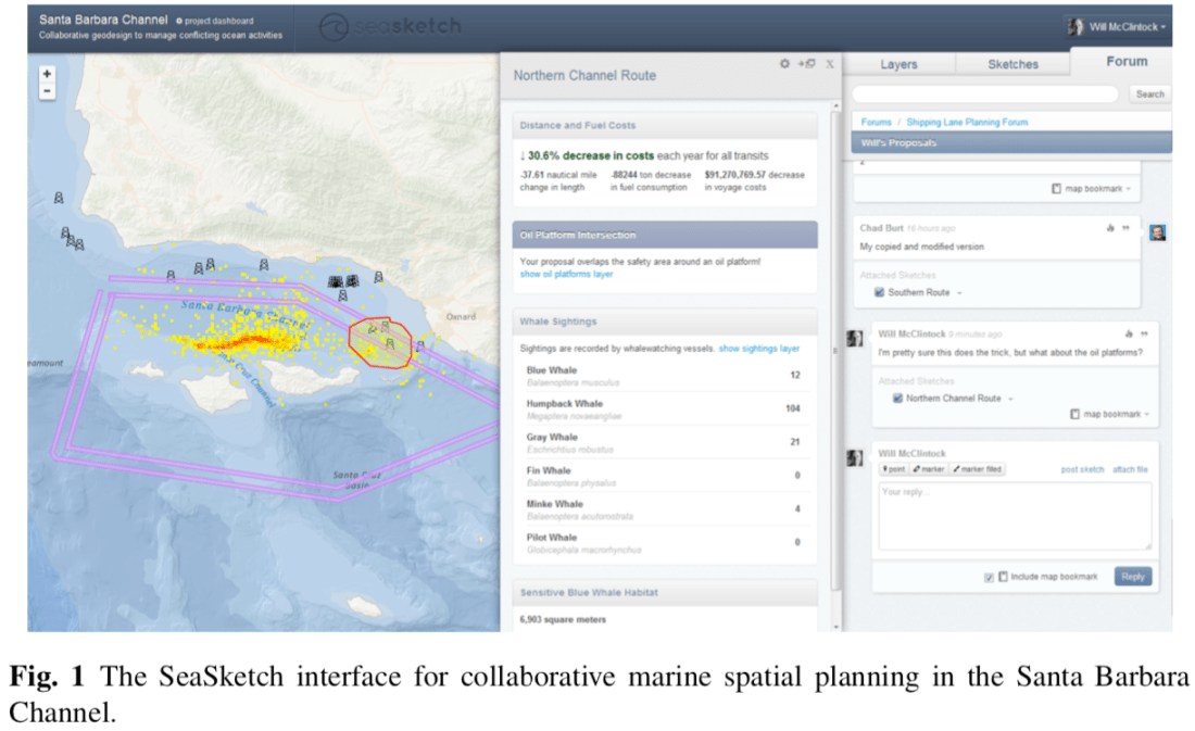
Abstract: Since its emergence in the 1990s, the area of Participatory GIS (PGIS) has generated numerous interactive mapping tools to support complex planning processes. The need to involve non-expert users makes the usability of these tools a crucial aspect that contributes to their success or failure. While many approaches and procedures have been proposed to assess usability in general, to date there is no standardized way to measure the overall usability of a PGIS. For this purpose, we introduce the Participatory GIS Usability Scale (PGUS), a questionnaire to evaluate the usability of a PGIS along five dimensions (user interface, spatial interface, learnability, effectiveness, and communication). The questionnaire was developed in collaboration with the user community of SeaSketch, a web-based platform for marine spatial planning. PGUS quantifies the subjective perception of usability on a scale between 0 and 100, facilitating the rapid evaluation and comparison between PGIS. As a case study, the PGUS was used to collect feedback from 175 SeaSketch users, highlighting the usability strengths and weaknesses of the platform.
Keywords: Participatory GIS; PGIS; Participatory GIS Usability Scale (PGUS); Usability evaluation; User experience; Web mapping
Reference: Ballatore A., Scheider S., Spierings B. (2020) Towards a Usability Scale for Participatory GIS. In: Kyriakidis P., Hadjimitsis D., Skarlatos D., Mansourian A. (eds) Geospatial Technologies for Local and Regional Development. AGILE 2019. Lecture Notes in Geoinformation and Cartography. Springer, Cham [pdf] [web]
